Leica Geosystems unveils new airborne Lidar sensor
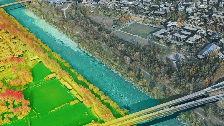
Leica Geosystems, part of Hexagon, has launched the Leica TerrainMapper-3 airborne Lidar sensor, featuring new scan pattern configurability to support the widest variety of applications and requirements in a single system. The new airborne mapping system provides application flexibility by offering an adjustable field of view up to 60 degrees and three scan patterns.
Continuing Leica Geosystems' renowned legacy of Lidar efficiency, the TerrainMapper-3 offers three advanced scan patterns to elevate productivity and tailor sensor performance to specific applications. Circle scan patterns excel in enhancing 3D modeling of urban landscapes and steep terrains, while ellipse scan patterns optimize data capture for traditional mapping tasks. Additionally, skew ellipse scan patterns are designed to enhance point density, particularly beneficial for infrastructure and corridor mapping applications.
Advanced point classification
The sensor’s higher scan speed rate allows customers to fly the aircraft faster while maintaining the highest data quality, and the 60-degrees adjustable field of view maximizes data collection with fewer flight lines. The TerrainMapper-3 is further complemented by the Leica MFC150 4-band camera, operating with the same 60-degree field of view coverage as the Lidar for exact data consistency.
Thanks to reduced beam divergence, the TerrainMapper-3 provides improved planimetric accuracy, while new MPiA (Multiple Pulses in Air) handling guarantees more consistent data acquisition, even in steep terrain, providing users with unparalleled reliability and precision. The new system introduces possibilities for real-time full waveform recording at maximum pulse rate, opening new opportunities for advanced and automated point classification.
The TerrainMapper-3 seamlessly integrates with Leica HxMap end-to-end processing workflow, supporting users from mission planning to product generation to extract the greatest value from the collected data.
“We recognized the critical need for an efficient, fully configurable solution to support multiple Lidar applications in a single system," said Layton Hobbs, airborne product line director at Leica Geosystems. "With its exceptional accuracy and versatility, and cutting-edge technology, the Leica TerrainMapper-3 opens up a world of possibilities and it's a game-changer for a data-driven future.”


Value staying current with geomatics?
Stay on the map with our expertly curated newsletters.
We provide educational insights, industry updates, and inspiring stories to help you learn, grow, and reach your full potential in your field. Don't miss out - subscribe today and ensure you're always informed, educated, and inspired.
Choose your newsletter(s)


